Posts

Showing posts with the label Week 1

Day 7 - Crow Butte State Park to Walla Walla

Image
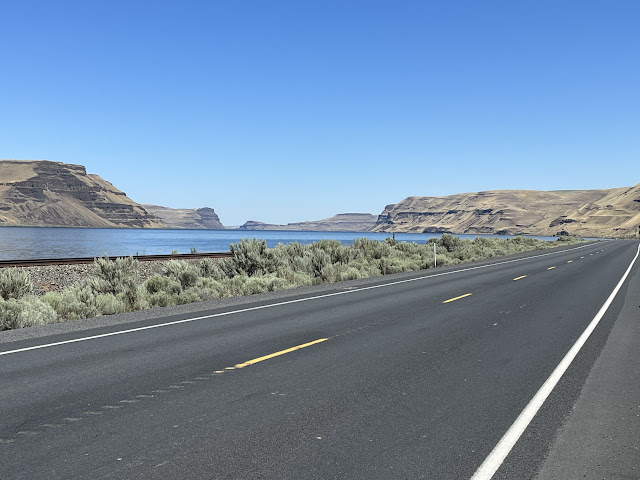
  Stats:   Today's miles :   90 miles Today's feet of elevation gain:   2,306  feet Total miles traveled:   40 1.5 miles Total feet climbed:   15,743 feet Emboldened by the previous day and hoping to shave off another day from the ‘conservative plan’ (and the prospect of a bed and AC) I decided to push to go all the way to Walla Walla. While I’d hoped for a repeat of the good conditions on Friday, I was disappointed by a 10 mph tailwind that diminished throughout the day and a more challenging set of climbs throughout the day (even though less total gain than on Fri.). I made good progress to Umatilla and crossed back to Oregon from Washington. Stopped for breakfast at Rae’s Dayz café . Great food and nice folks. I had a guy pull up a chair and ask about my ride. He had done a west coast-to Mexico ride about 10 yrs ago and wanted to know about my trek. After we had finished, the gal at the next table offered her best wishes for the trip and sugges...

Day 5 - Rest, Day 6 - The Dalles to Crow Butte State Park

Image
  Stats:   Today's miles :   93 miles Today's feet of elevation gain:   3,145 feet Total miles traveled:   311.5 miles Total feet climbed:   13,437 feet It was a really good day of cycling. I was on the road from The Dalles by 6 AM, the forecast high temp had dropped from 94 to 88F (hey little victories) and a 25 mph wind was blowing up-river (tailwind). The ride to Biggs was crazy. There was a section of 3 miles on I84 where I never pedaled, since the wind was strong enough to sustain my normal speed. When I reached Biggs I stopped at the truck stop for a quick breakfast sandwich and coffee before crossing the bridge and beginning the 83 mi “limited services area” run on the Washington side of the river.  Perhaps I was a bit too cocky at that point, because when I came out of the truck stop, my rear tire had relieved itself. Damn those shredded steel belts on the roadside! At least it was in a parking lot and it only took two tubes ( note be extra ca...

Day 4 - Cascade Locks to The Dalles

Image
Stats:   Today's miles :   48.2 miles Today's feet of elevation gain:   3,137 feet Total miles traveled:   218.5 miles Total feet climbed:   10,292 feet After finding the construction detour and getting back on the route out of Cascade Locks the first challenge of the day was the climb up Herman Creek road. The Adventure Cycling map warns that it is steep, they just didn’t say how STEEP. After less than a qtr mile in granny gear, I realized I could walk faster and did so for the next mile!! The last 6 miles going into Hood River is normally routed on I84. However due to construction, ironically, of the last section of the bicycle trail, the lanes are reduced (no shoulder) and cyclists are routed through the construction zone ! After 2 miles over rubble and dozer tracks, I hit the active construction zone, lost traction and promptly did a ‘Joe Biden’, however no Secret Service guys helped me up! (Check out the video on YouTube including the fall https://youtu.be/...

Day 3

Image
Stats:   Today's miles :   45.3 miles Today's feet of elevation gain:   2,448 feet Total miles traveled:   170.3 miles Total feet climbed:   7,155 feet Started from Portland around 8:30. The route continued along the Columbia and then followed Historic 30 up and down on the “Falls Trail”A beautiful route but a lot of climbs and descents. I made it to Cascade Locks and planned another 10 mi to Viento State Park, however 3 mi out of town the bridge is closed. Since it was already 5:00 and I didn’t know the alternate bike route (thanks locals for the info) I opted to camp at the nearby KOA Overlooking the Columbia Horsetail Falls Camp for the Day Dinner

Day 2

Image
Stats:   Today's miles : 63 miles Today's feet of elevation gain: 1,507 feet Total miles traveled:   125 miles Total feet climbed: 4,707 feet With a late arrival and a limited evening meal the night before, I intentionally was slow to break camp and ended up leaving at 9:30. Today was planned to be a shorter ride since it involved a complicated route through Portland and getting to the next campground would have required 90+ miles. The ride was largely uneventful and getting through Portland while challenging was not that bad. The last leg took the Columbia river bike trail and airport service road. As humbling reminder that it isn’t always a smooth road, I ended up with a rear flat about 2 miles short of my destination. Walking the bike down to a flat spot off the road, taking all the gear off and replacing a tube is a great way to spend the late afternoon with a view of Mt. Hood Just a note…The terrain, narrow roads and limited services will make the climb out of the Colu...

Day 1

Image
Quick stats: 62 miles, 3200 feet of elevation gain We drove to Sunset Beach south of Astoria. By the time we drove there, packed the bike and made several returns to the car for forgotten items, quick repairs (loose fender) I finally took off at 11:30 am. No traditional dipping the tire in the Pacific. It was low tide with about 200 yards of sand/mud to the ocean and breaking 6’ waves. I rode PC 101 and business 101 into Astoria. What no one tells you is that this route climbs to the highest point and immediately drops into the main part of town on the other side. The route followed Hwy 30 with several climbs and descents as it headed back to Portland. The scenery is beautiful old growth timber in several spots. However, most of my concentration was on the road, with a steady stream of cars and RVs heading back from the weekend and no or limited shoulders in several stretches. I stopped to rest in Clatskanie after a long climb and dropping, hoping to camp there for the night. With no c...